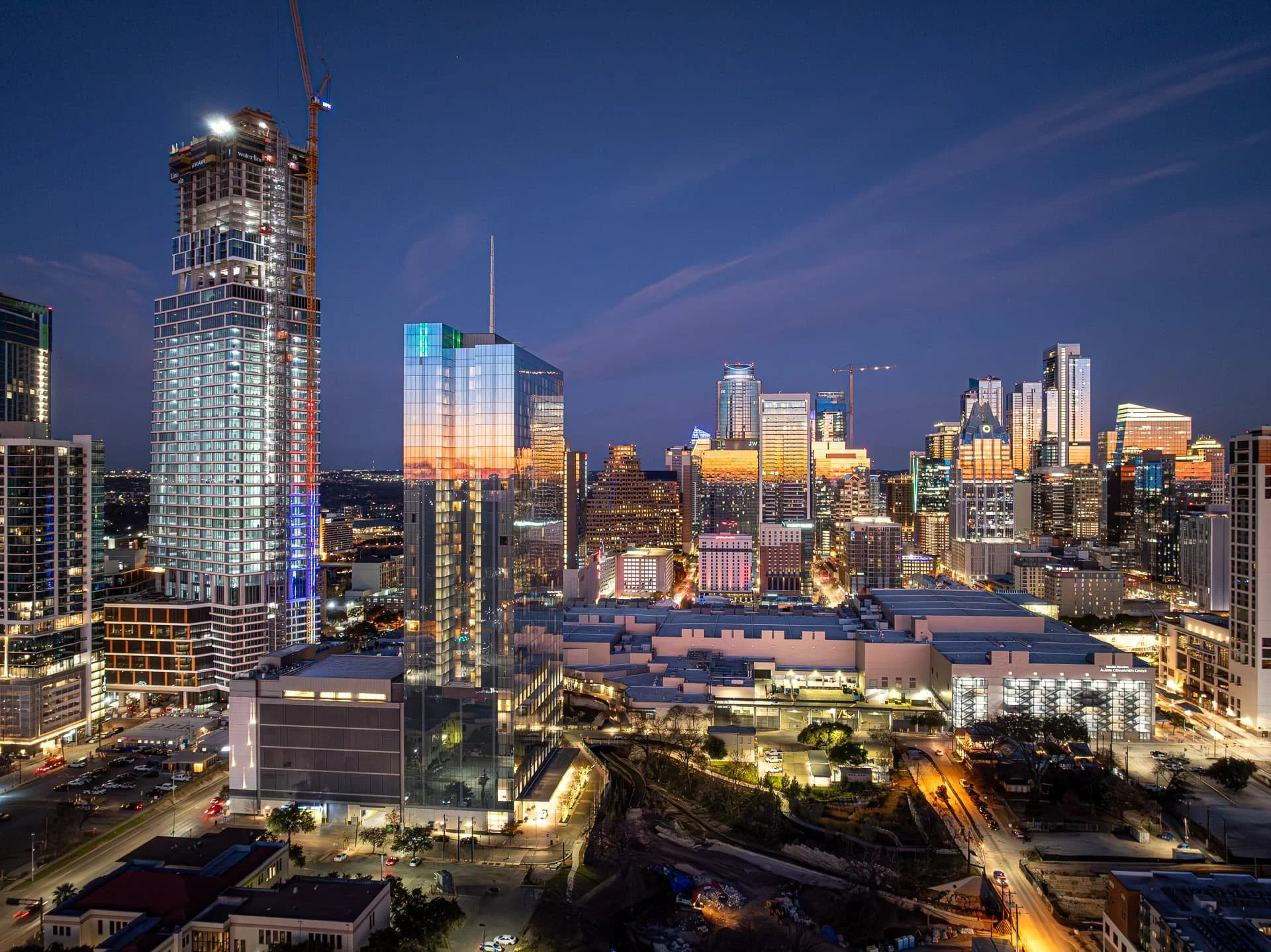
Austin Drone Photography & Aerial Videography Services
Construction, Real Estate, and Inspections Across Central Texas
Our FAA Part 107 certified drone pilots deliver high-resolution aerial photography and 4K video that meet the strictest city and state requirements. From Section 01380-compliant construction documentation to stunning real estate marketing visuals, we provide on-time, on-spec, and on-budget drone services throughout Austin, San Antonio, Dallas, Houston, and across Texas.
Based in Austin — Serving all of Central Texas and beyond
FAA Part 107 Certified | Fully Insured | Section 01380 Compliant
Why Choose Our Aerial Services?

Fast Turnaround
Projects are typically completed and delivered within 2–3 business days, weather permitting.

Professionally Edited Visuals
All aerial images and videos are color-corrected and formatted for use across web, print, reports, and presentations.

Compliance-Ready Deliverables
File naming, metadata tagging, and documentation aligned with Section 01380 and city specs.

FAA Certified & Fully Insured
All flights are conducted by a licensed FAA Part 107 drone pilot with full general liability coverage.
Organized Cloud Delivery
GPS-tagged, labeled folders delivered via secure repository with long-term access.

Satisfaction Guaranteed
If expectations aren’t met, we’ll re-shoot—no additional charge.
Industries We Serve
At Gaston Cherry Photography, we know every industry has unique aerial needs. That’s why our drone photography and videography services are tailored for:
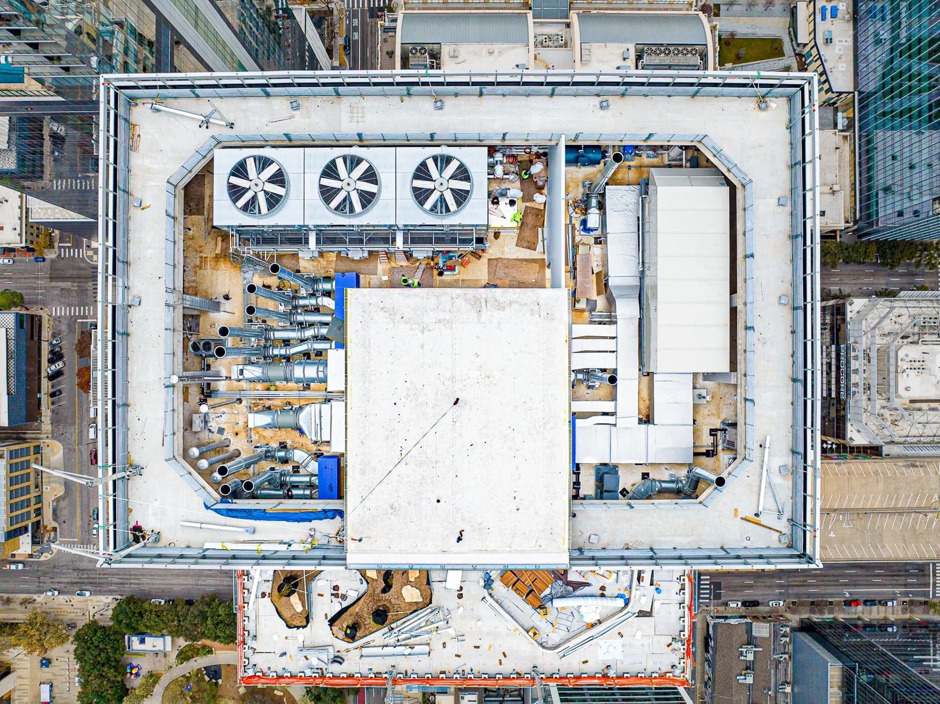
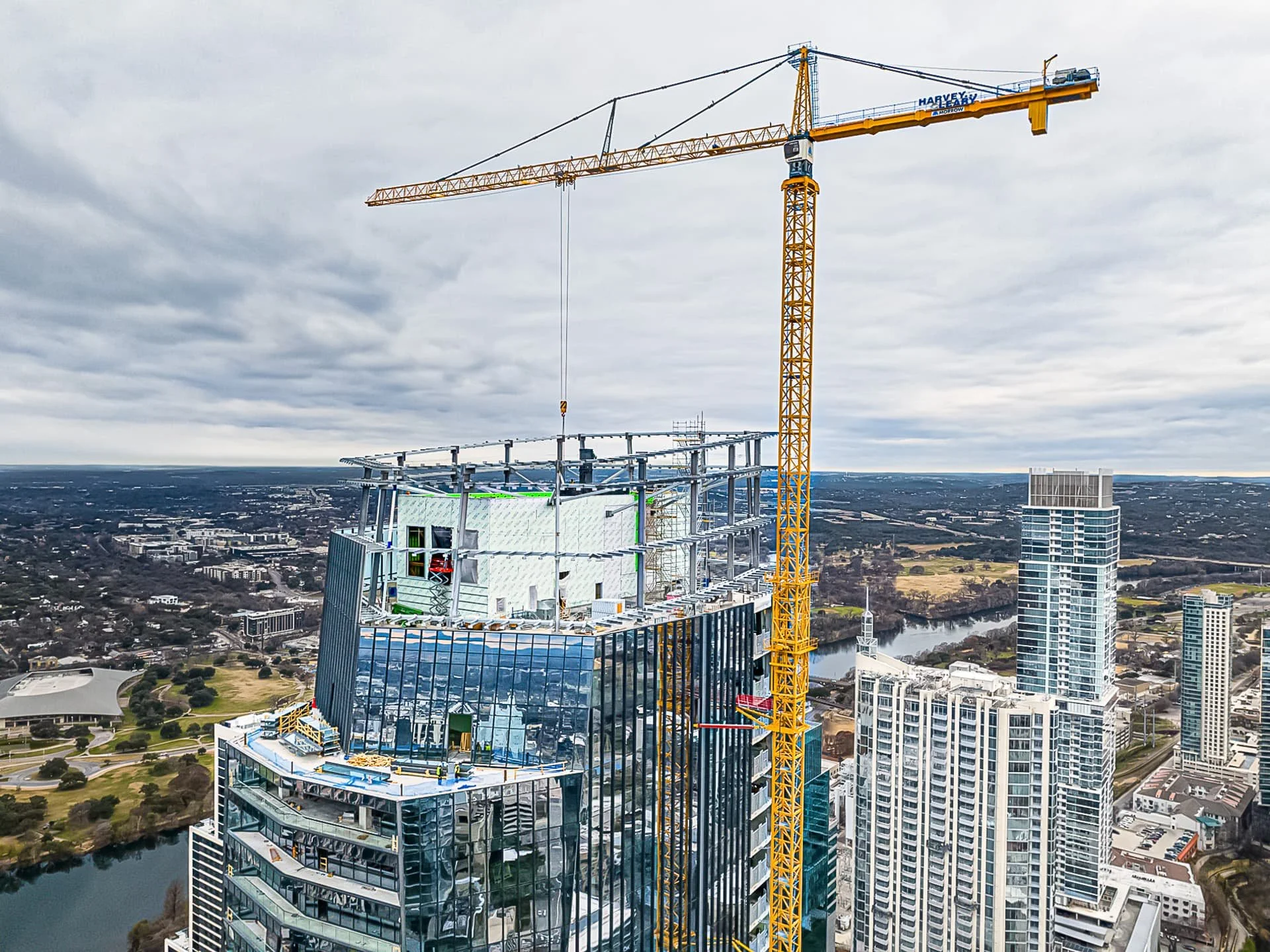
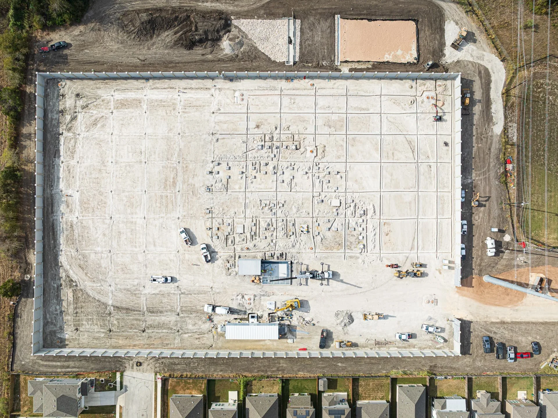
Construction progress and compliance documentation
Residential and commercial real estate marketing
Infrastructure and utility inspections
Developers, contractors, and city agencies

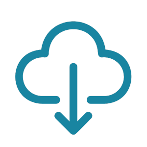
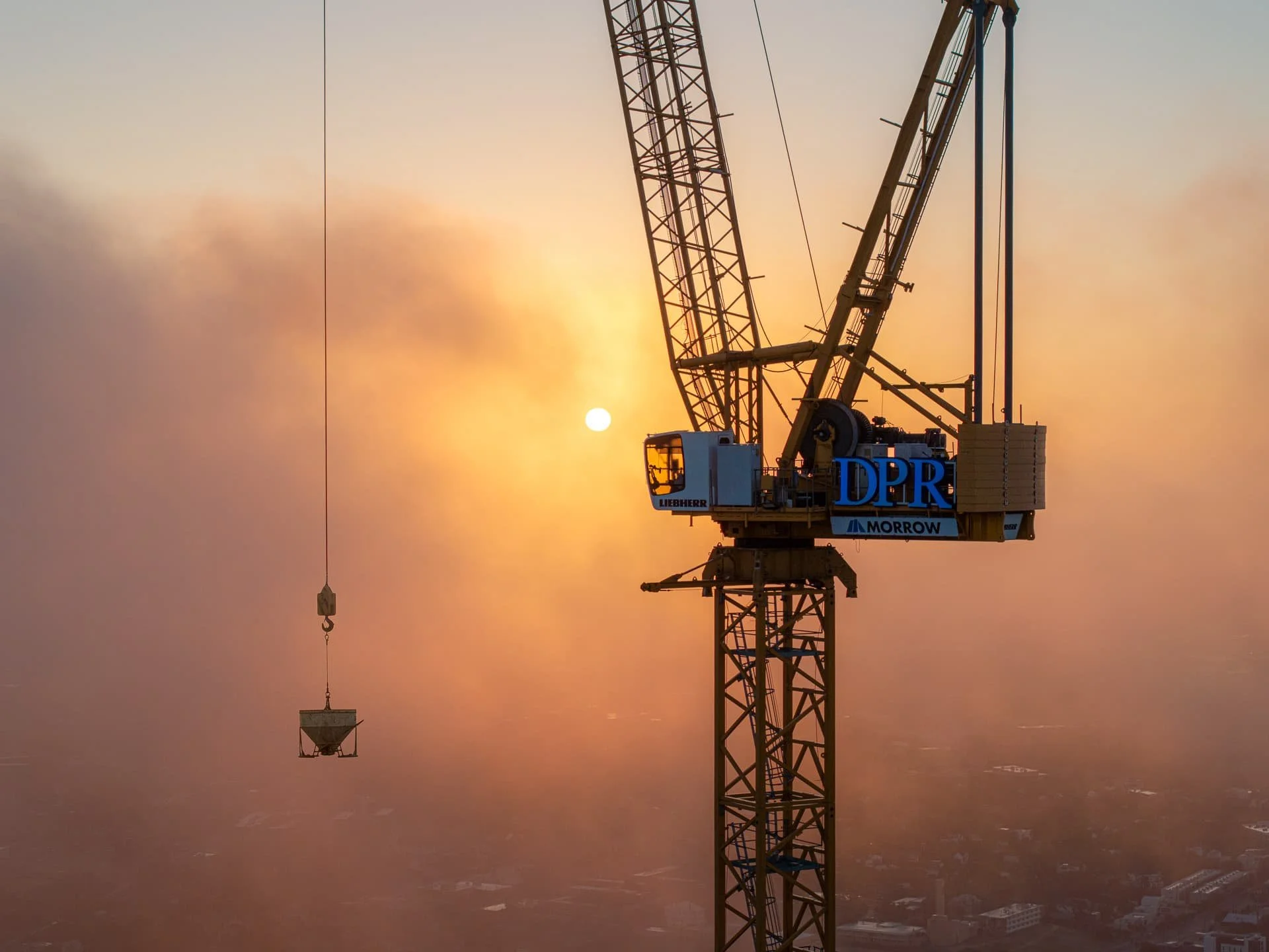
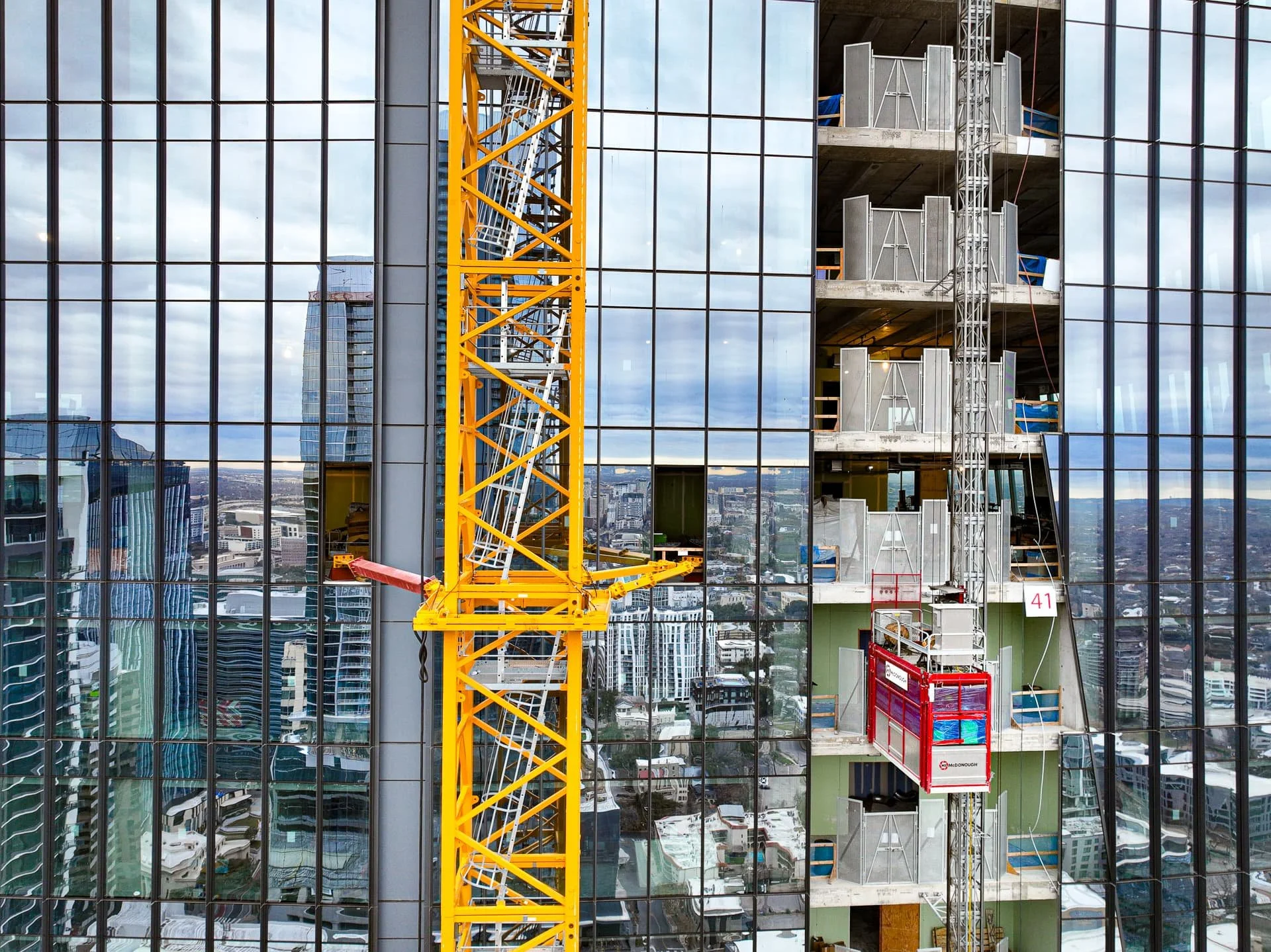
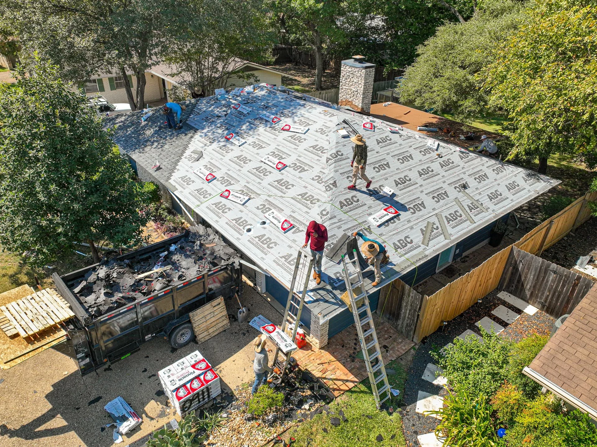
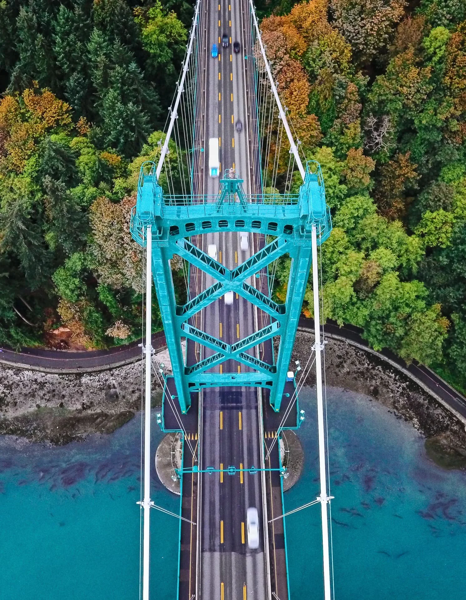
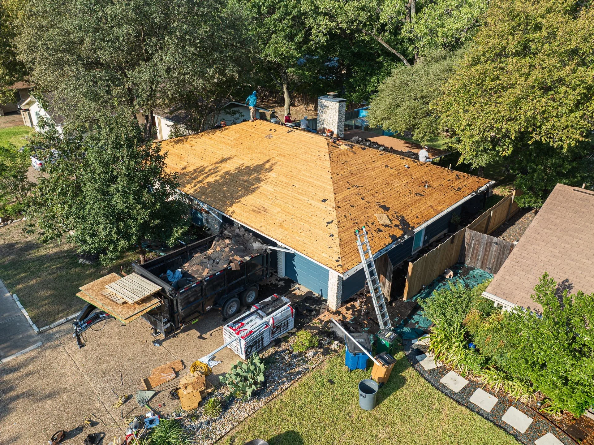
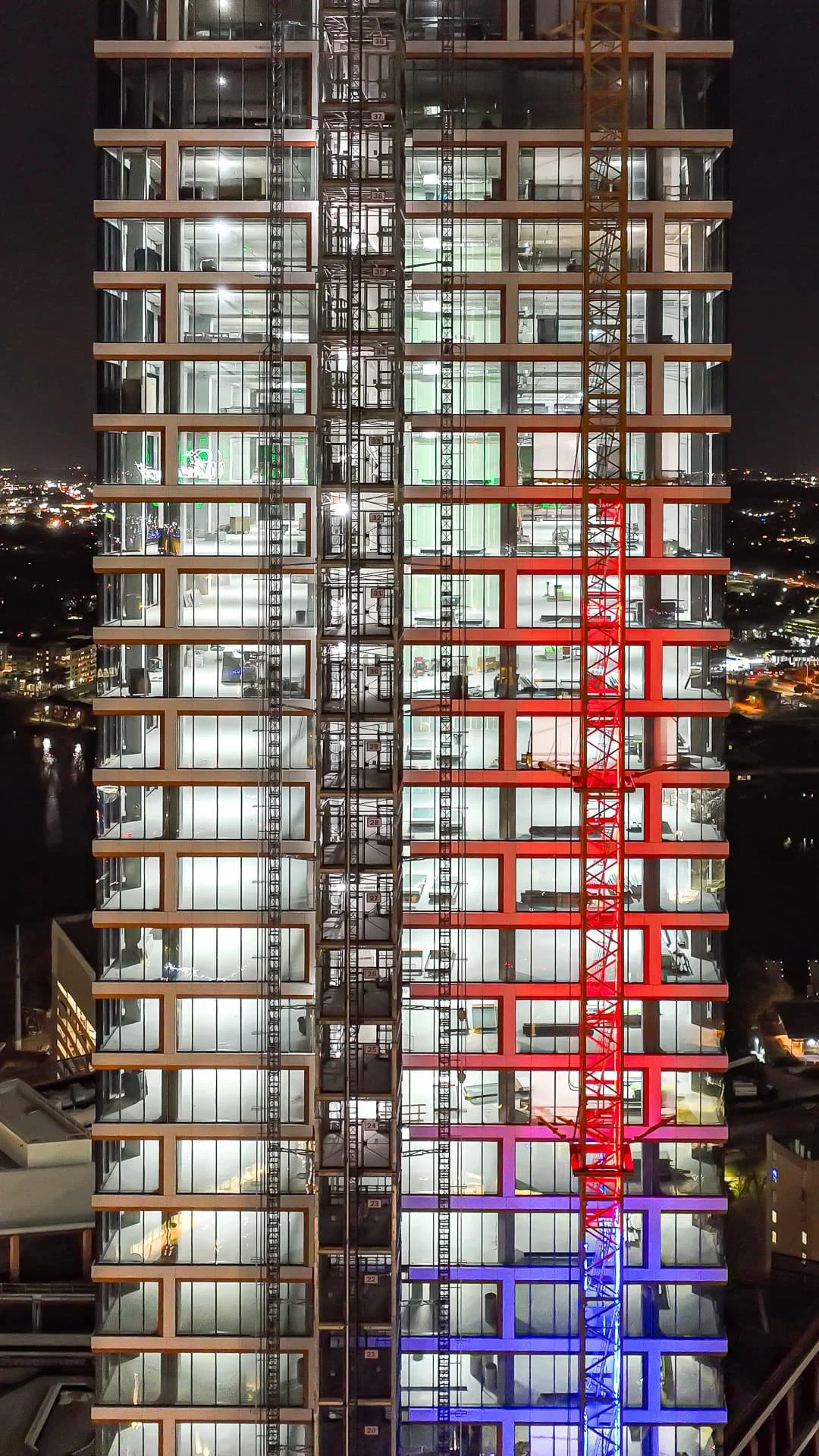
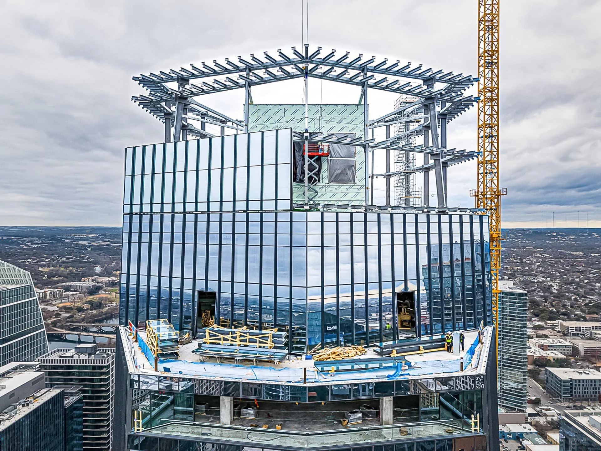
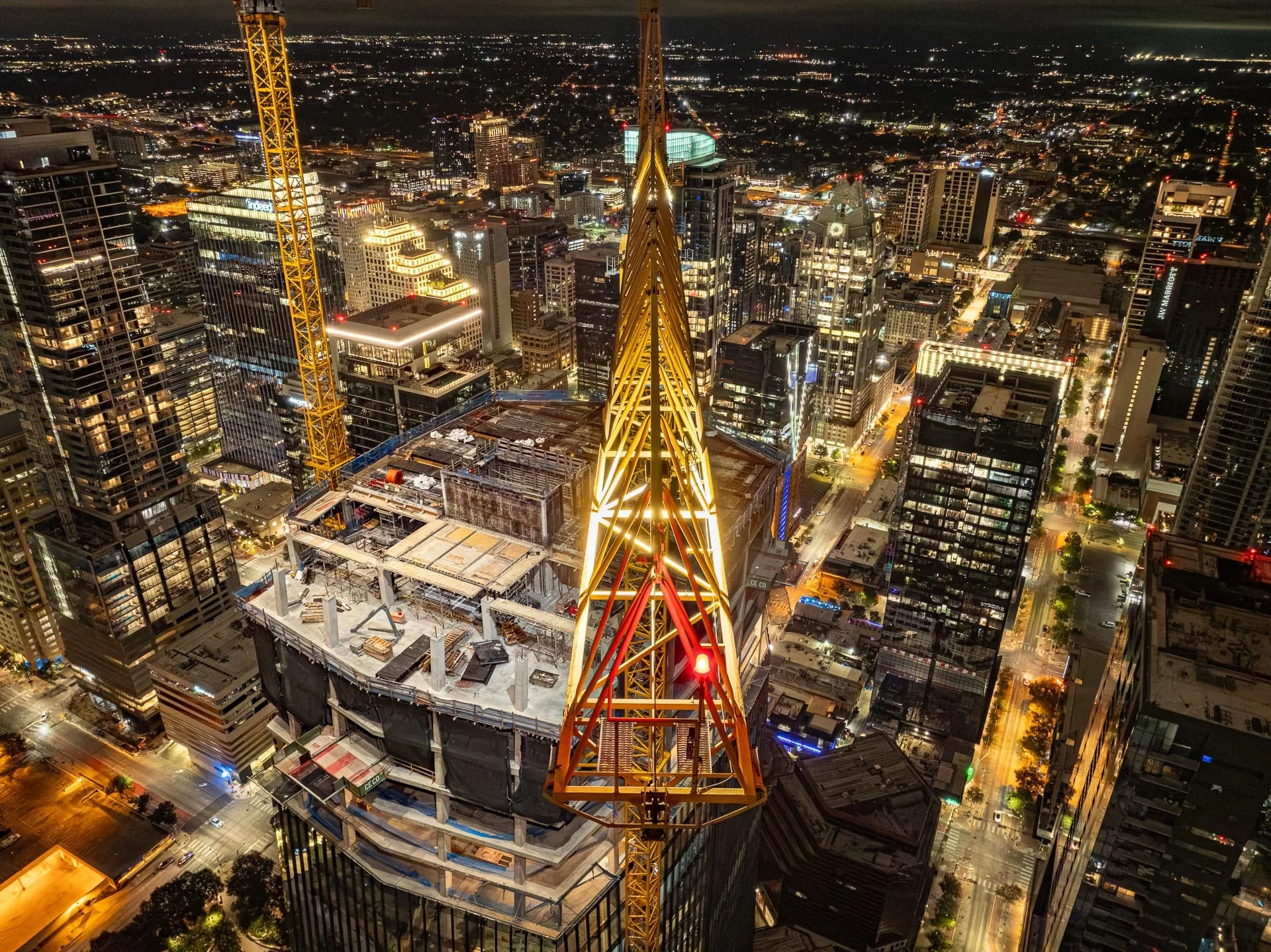
Construction Drone Photography In Central Texas
Capture progress with precision. Our scheduled flyovers deliver consistent aerial documentation that improves reporting, enhances communication, and keeps projects on track.
-
Progress Milestones – Foundation work, framing, MEP (mechanical, electrical, plumbing), and finishing stages.
Critical Installations – Roads, bridges, stormwater systems, utilities, and other infrastructure elements.
Safety & Compliance Views – Proper PPE use, barricades, signage, and OSHA requirements.
Before & After Comparisons – Pre-construction vs. post-construction visuals for project closeout.
-
Reduced need for on-site inspections by engineers and stakeholders
Consistent photo documentation for payment applications and compliance
Improved safety with less foot traffic in active zones
Faster decision-making with immediate aerial visibility

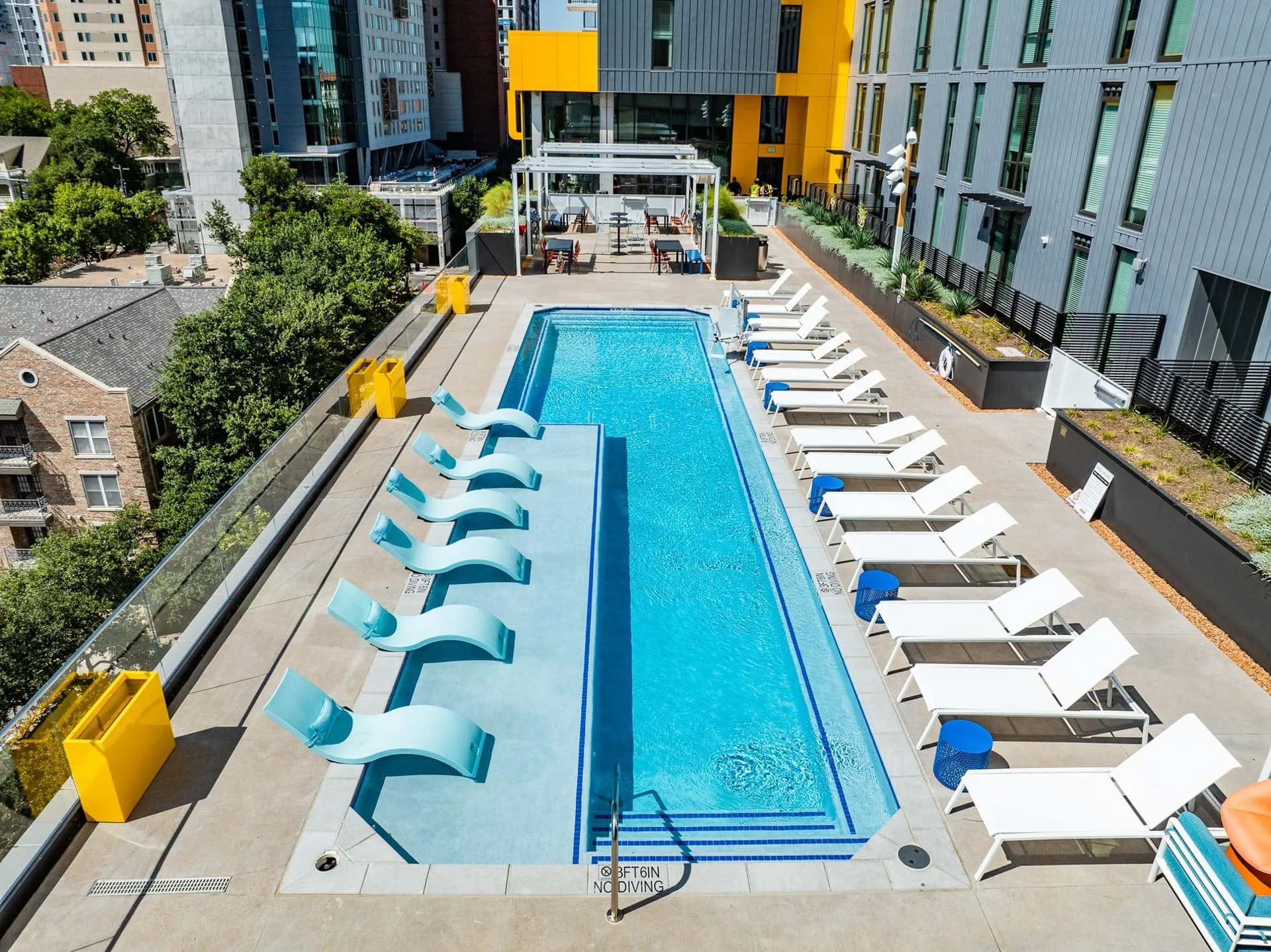
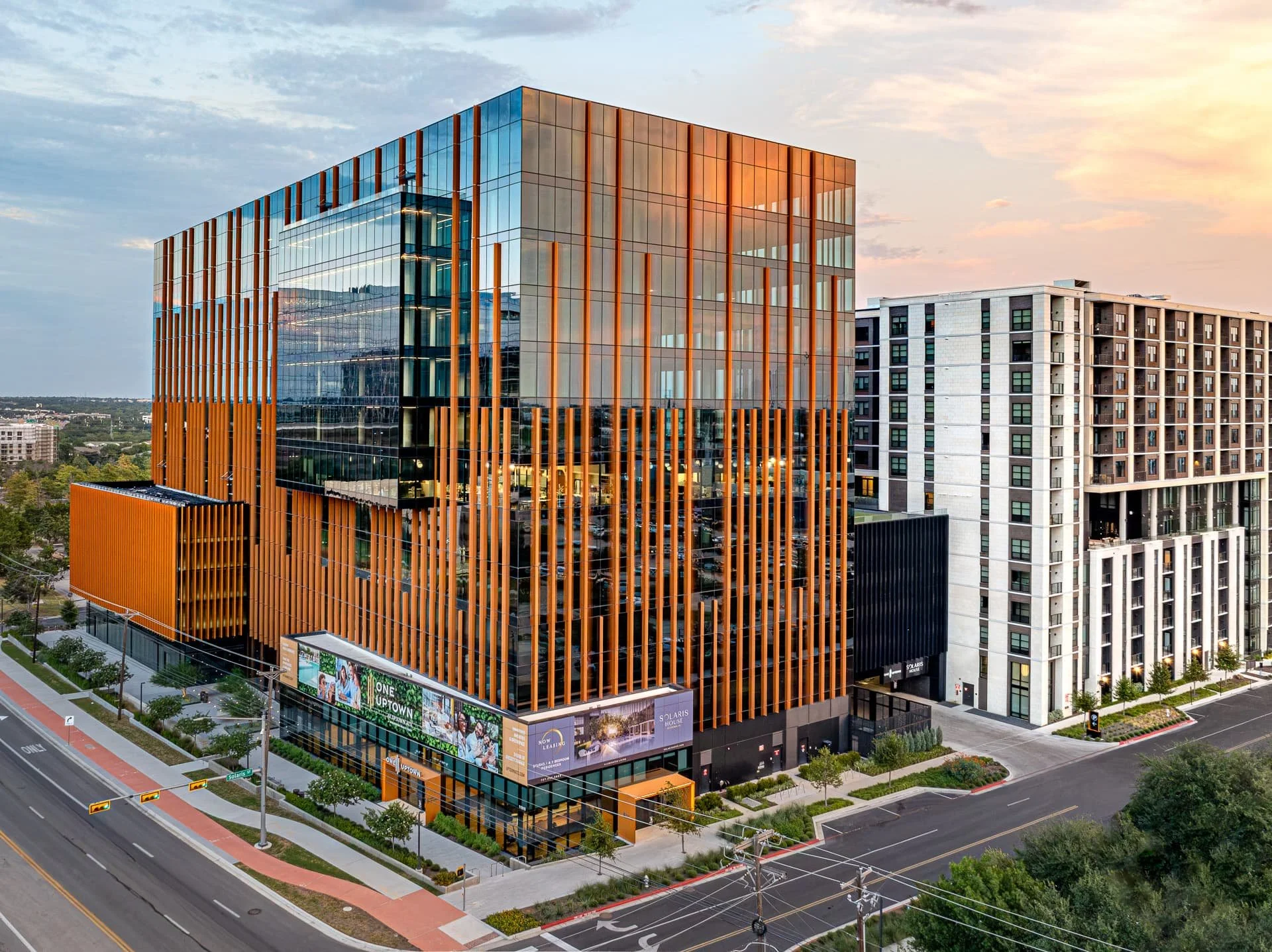
Residential Real Estate Drone Photography
Sell faster and attract more buyers.
Professional aerial photos and 4K video tours showcase your property’s layout, landscaping, and neighborhood features—giving buyers the full picture.
-
Property Boundaries – Accurate lot lines, fences, and acreage highlights.
Curb Appeal – Rooflines, landscaping, pools, and outdoor living spaces.
Neighborhood Context – Schools, parks, trails, and nearby attractions.
Unique Selling Features – Waterfront access, hill country views, or private amenities.
-
More engaging than static ground-level photos
Highlight scale, location, and lifestyle in a single aerial view
Boosts online listing engagement and buyer inquiries
Helps agents and sellers stand out in a competitive market
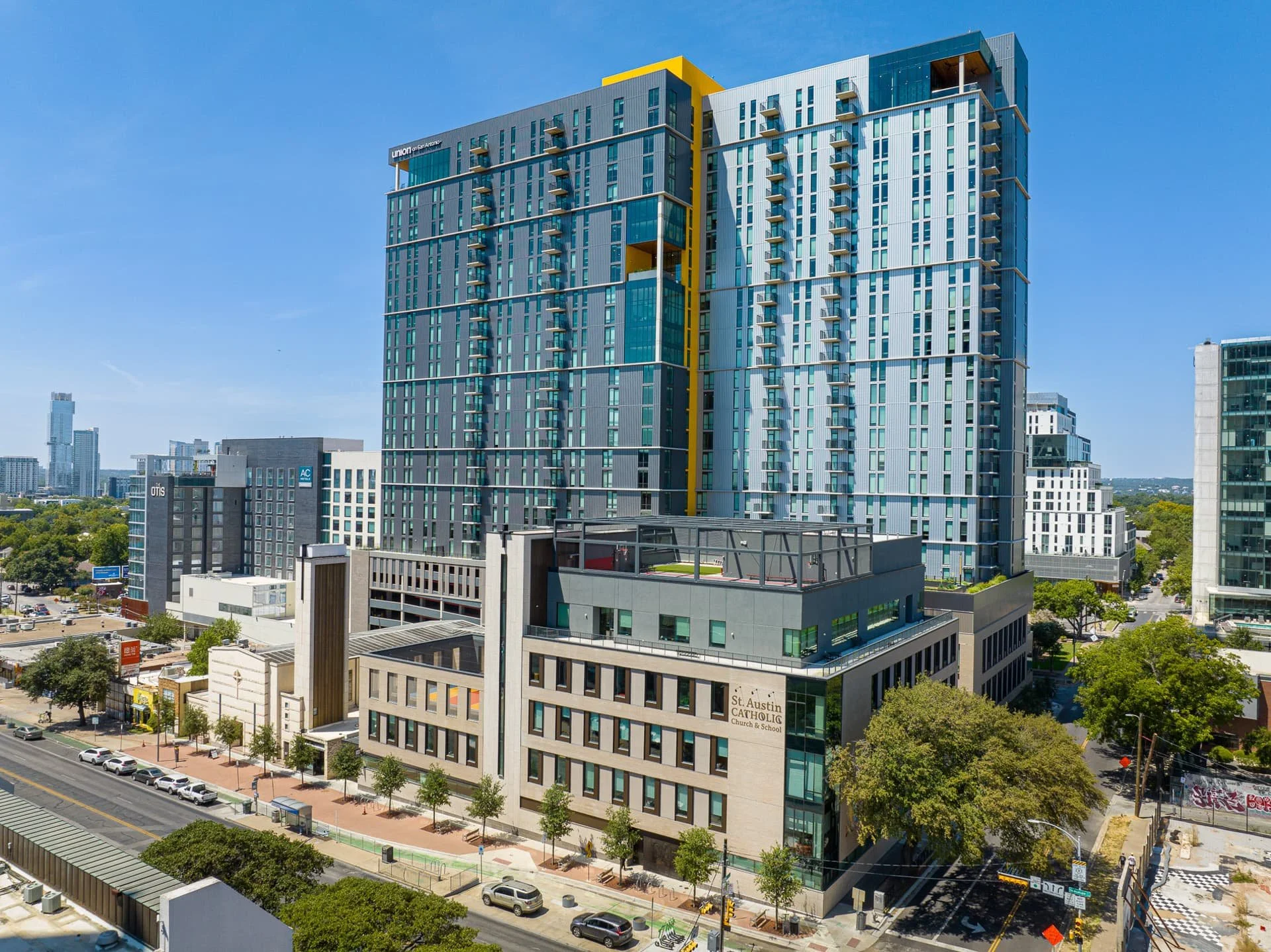
Give investors and tenants the full picture.
Our aerial visuals highlight site scale, access, and surroundings—delivering powerful marketing tools that drive investor and tenant decisions.
-
Building Size & Layout – Showcase square footage, parking capacity, and entrances.
Surrounding Infrastructure – Highlight proximity to highways, public transit, and major employers.
Retail & Lifestyle Amenities – Display nearby restaurants, shopping centers, and entertainment.
Development Opportunities – Demonstrate unused land or expansion potential.
-
Provides a “big picture” perspective traditional photography can’t match
Faster property marketing with high-quality visuals ready in days
Saves brokers money vs. expensive helicopter or plane shoots
Stronger presentations for investors, tenants, and lenders
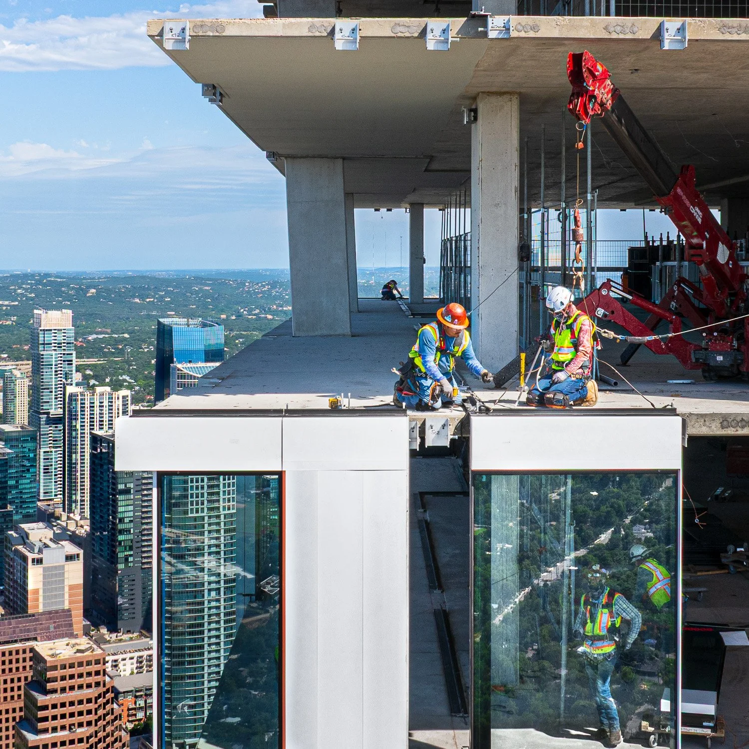
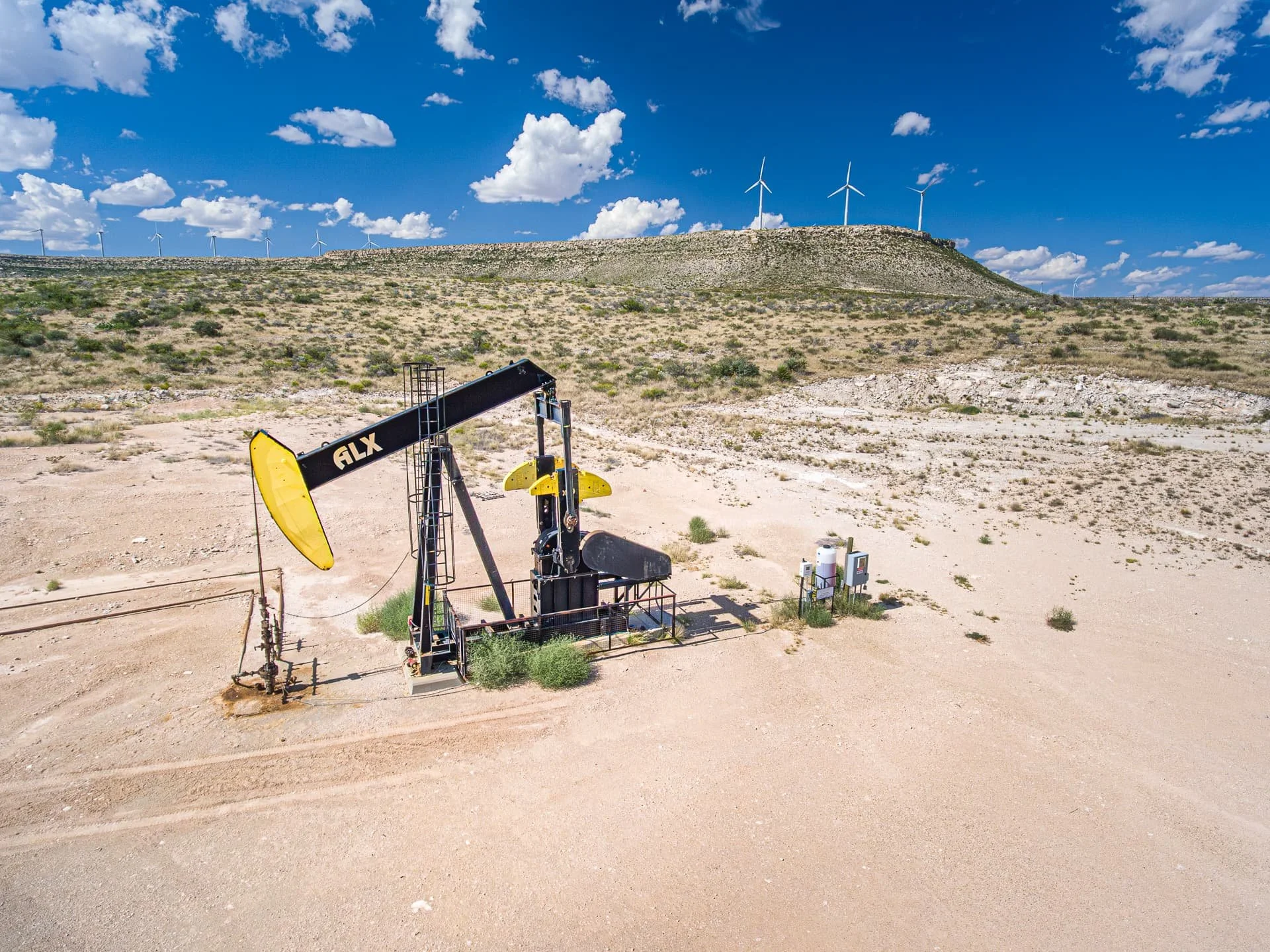
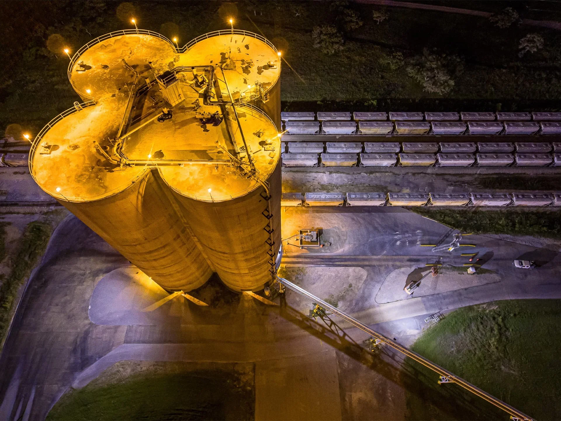
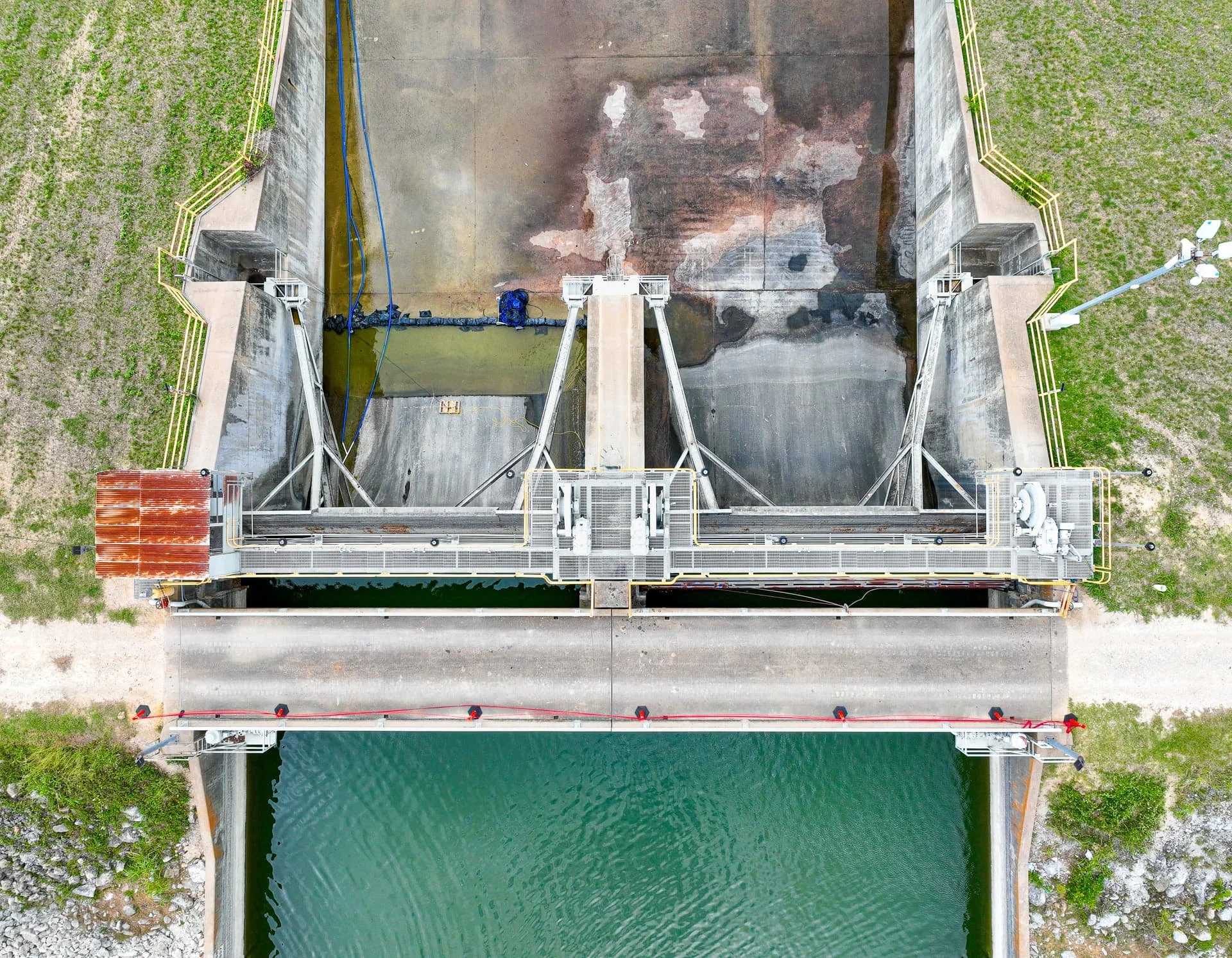
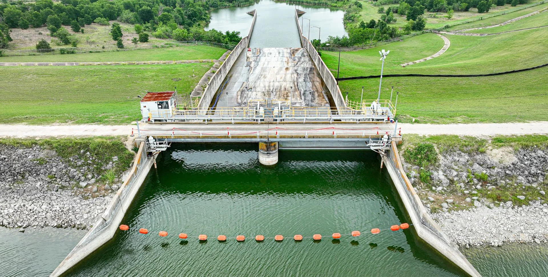
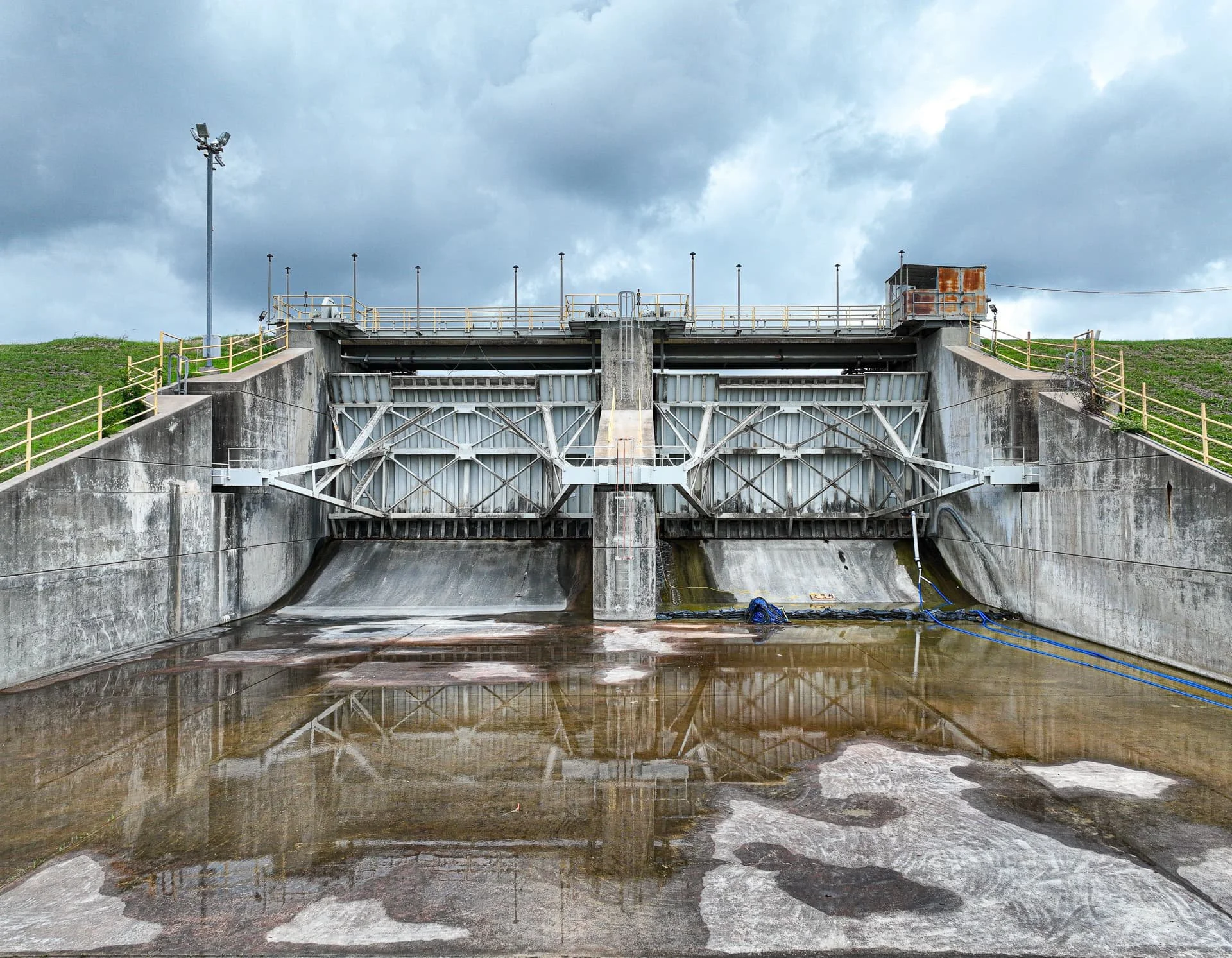
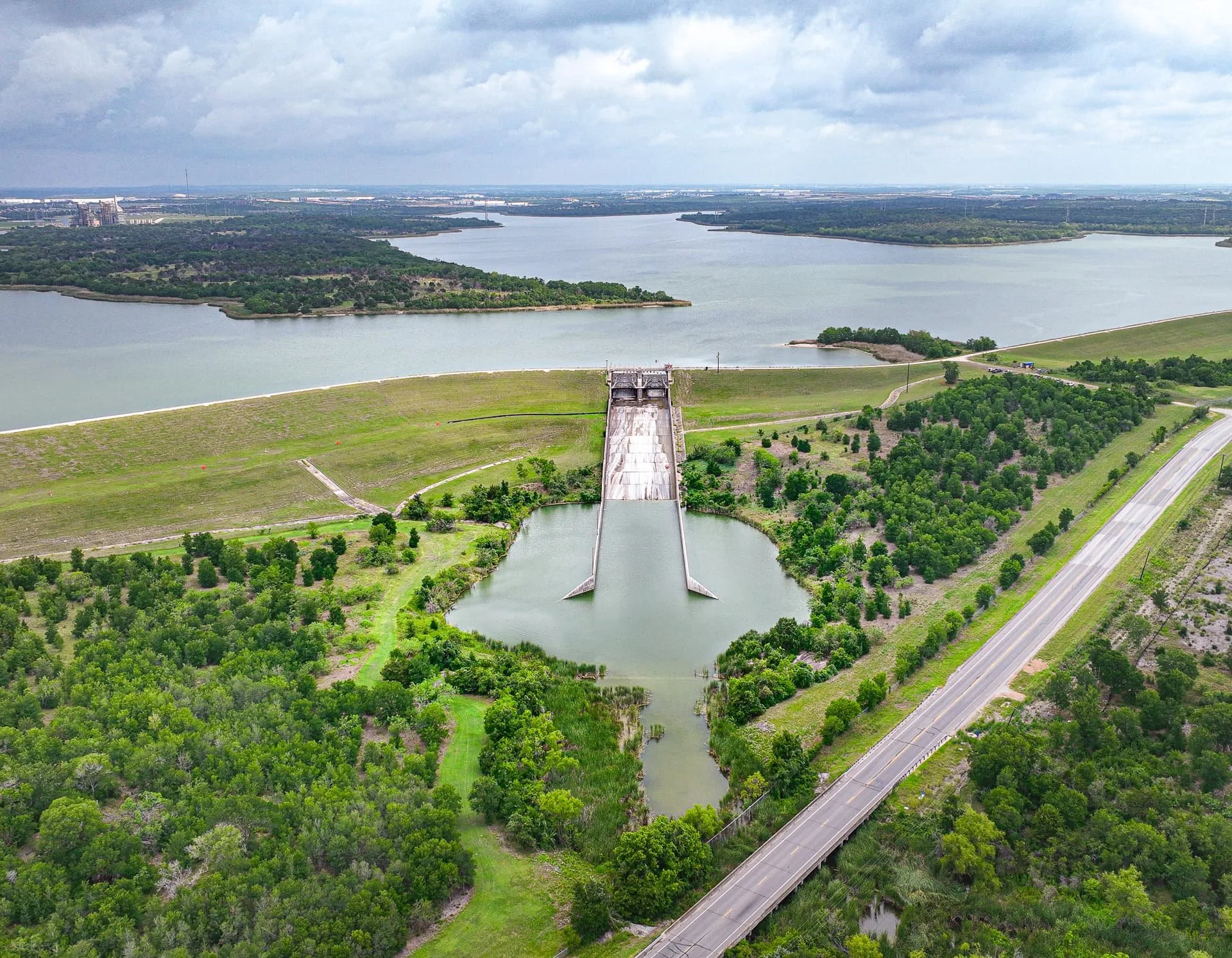
Drone Inspections for Infrastructure & Utilities
Inspect hard-to-reach assets safely and efficiently.
High-resolution drone imagery reduces costs, minimizes downtime, and delivers immediate insights for faster decision-making.
.
-
Structural Integrity – Roofing, façades, towers, bridges, and hard-to-reach assets.
Utility & Energy Assets – Power lines, solar fields, pipelines, and wind turbines.
Damage & Maintenance Needs – Storm damage, leaks, corrosion, or wear.
Documentation for Reporting – GPS-stamped photos and video for engineering review.
-
Reduce Costs & Improve Safety with Drone Inspections
Safer—no scaffolding, lifts, or rope access required
Faster—large sites documented in a single flight
Cost-efficient—reduced inspection time and equipment needs
Detailed—zoom capability reveals issues invisible from ground level
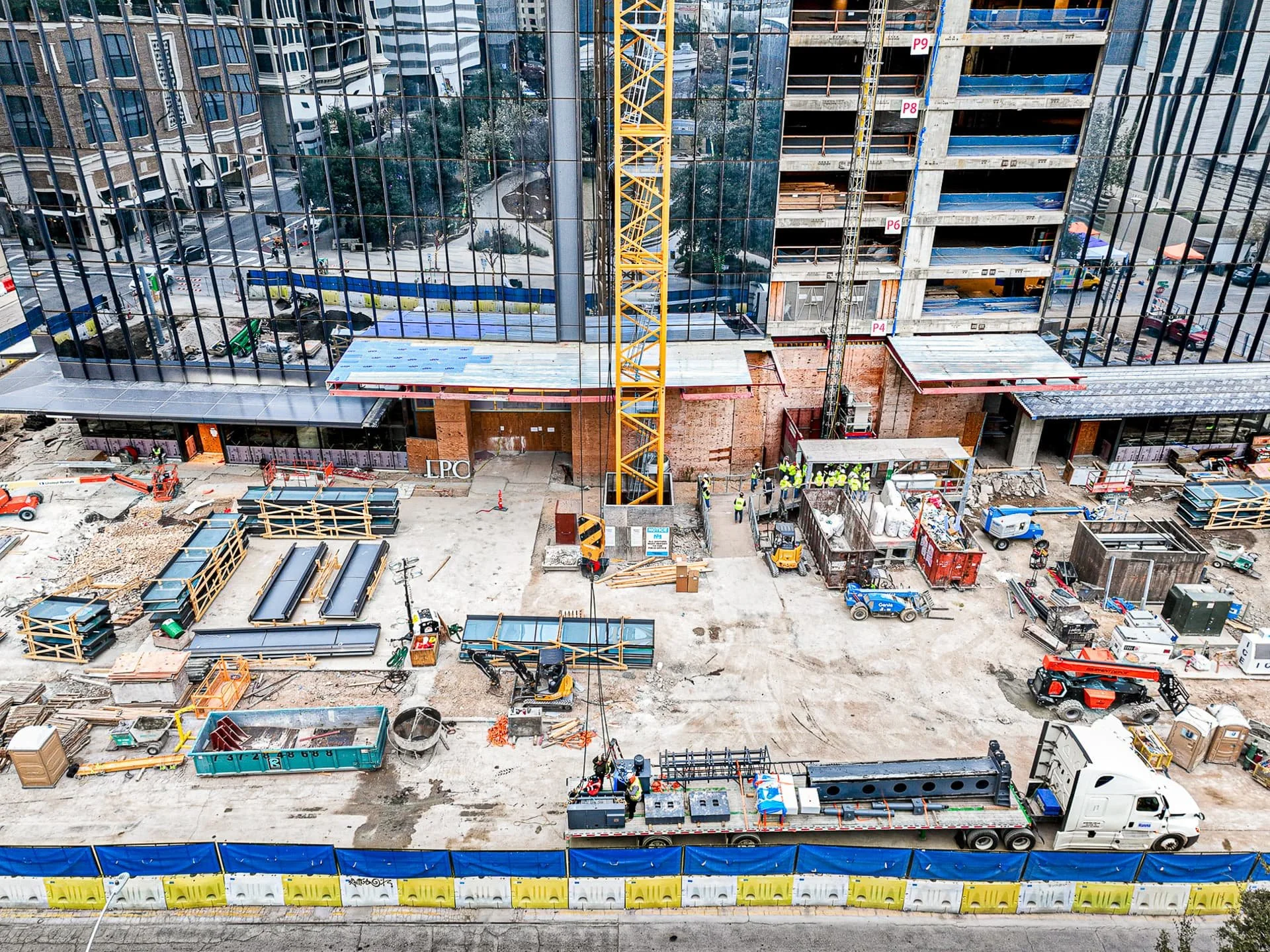
Commercial Real Estate Drone Videography
Our Aerial Deliverables
High-resolution aerial photographs (JPG & TIFF)
4K and HD drone video footage (MP4 or MOV)
Oblique and top-down views for comprehensive coverage
File labeling per spec (location, direction, date, CIP ID, etc.)
GPS-embedded metadata for compliance and tracking
Web-ready exports and full-resolution master files
Optional: PDF photo books, timelapse sequences, narrated video walkthroughs
Licensed. Certified. Ready to Fly.
As a certified WBE/MBE/DBE/HUB vendor and FAA Part 107 drone operator, we provide trusted aerial services for both public and private sector clients. We're proud to support:
Section 01380-compliant construction documentation
Civil infrastructure and land development
Real estate marketing (residential & commercial)
Progress tracking and site inspections
Promotional content for developers, contractors, and city agencies


FAQs
-
Yes. All our drone operations are conducted by an FAA Part 107 certified remote pilot, as required by federal law for any commercial drone work.
-
Yes. We are experienced in obtaining LAANC approvals and airspace authorizations for restricted zones, including operations near airports and downtown Austin. We plan every flight with safety and compliance in mind.
-
Usually, no—but it depends on the location. For public property or city-managed spaces, we can assist with obtaining any necessary drone permits or flight authorizations. For private property, you’ll just need permission from the owner.
-
We’re based in Austin, Texas, and proudly serve Central Texas, including Round Rock, Pflugerville, San Marcos, Buda, Kyle, and nearby communities. We frequently travel to surrounding cities such as San Antonio, Houston, Dallas, Waco, and Temple, and are available for statewide projects across Texas.
For larger or recurring assignments, we’re also available to travel nationwide across the United States, and even internationally. Whether your project is local or global, we’ll meet you wherever your vision takes us.
Please contact us to discuss travel availability, custom packages, and project logistics.
-
Most projects are delivered within 2–3 business days, weather permitting. Turnaround time may vary slightly depending on the size and complexity of your project.
For larger sites, multi-location shoots, or time-intensive editing (like video walkthroughs or custom deliverables), we’ll confirm a delivery timeline in advance to keep everything on track.
Rush delivery is available—just let us know your deadline when booking.
-
High-resolution aerial photographs (JPG and optional TIFF)
4K or HD video (MP4 or MOV)
GPS-tagged files labeled by date, direction, and location
Web-ready and print-ready formats
Optional: PDF photo books or narrated video walkthroughs
-
Yes! Most of our clients do. We can capture both aerial stills and cinematic video during a single flight session, saving you time and cost.
-
Yes. We carry $2 million in general liability coverage and follow strict safety protocols on every flight.
-
Absolutely. We provide scheduled monthly, bi-weekly, or milestone drone flyovers for construction progress tracking and compliance documentation.
-
We monitor wind, rain, and visibility closely. If conditions aren’t safe or legal to fly, we’ll reschedule your session at no additional cost.
-
Yes! We also offer ground-based photography and video, including interiors, equipment, team portraits, and post-construction highlights. We can create a seamless visual package for your entire project.
-
Ofrecemos fotografía aérea y video 4K con drones para una variedad de industrias y proyectos en Texas y más allá. Nuestros servicios están dirigidos tanto al sector público como privado, y se adaptan a sus necesidades específicas.
Entre los servicios que ofrecemos se incluyen:
Monitoreo de obras de construcción
Vuelos programados para documentar el progreso de la obra, ideales para reportes, seguimiento y cierres de proyecto.Fotografía aérea para bienes raíces residenciales y comerciales
Imágenes desde el aire que destacan los terrenos, ubicación y alrededores para atraer más compradores o inversores.Inspecciones con dron
Evaluaciones visuales de techos, estructuras y áreas difíciles de alcanzar—sin necesidad de andamios o grúas.Documentación conforme a normas municipales (Sección 01380)
Imágenes geoetiquetadas, metadatos y archivos organizados según los requisitos de la Ciudad de Austin y otras entidades gubernamentales.Contenido promocional
Video y fotografía aérea para campañas de mercadeo de desarrolladores, agencias de la ciudad y empresas de construcción.
Todos los vuelos son realizados por un piloto certificado por la FAA (Parte 107) y con cobertura de seguro. También hablamos español y estamos aquí para ayudarle en cada paso del proceso.
-
Nuestra base está en Austin, Texas, y con gusto servimos toda el área de Texas Central, incluyendo Round Rock, Pflugerville, San Marcos, Buda, Kyle y ciudades cercanas. También viajamos con frecuencia a San Antonio, Houston, Dallas, Waco y Temple, y ofrecemos cobertura en todo el estado de Texas.
Para proyectos más grandes o recurrentes, también estamos disponibles para viajar a cualquier parte de los Estados Unidos o incluso al extranjero. Donde sea que esté su proyecto, podemos estar ahí para documentarlo con precisión y profesionalismo.
Por favor, contáctenos para conversar sobre la disponibilidad, paquetes personalizados y detalles logísticos.
Let’s Talk About Your Project
Every job is unique. We’ll tailor a package that fits your timeline, deliverables, and compliance requirements—whether you're managing a public works project or launching a new development.